Saturday, April 30, 2016

April 27, Wednesday, knocking around downtown

Distance: 10.56 km

Weight: Negligible
Weather: Roughly 58 degrees, clear weather
Elevation gain: 300 feet 
Accumulation elevation gain for 2016: 31,044 feet.
Accumulated distance hiked: 248.55 km
Notes: This was a day of light, low-stress R&R walking that complemented slightly stressful hike on prior day. Joined friend on day in Seattle; walk from home to 1st and Pine; to SA;, to tea shop and Chocolate Box; to Pike Place Market for lunch at Lowell's; to Original Starbuck's. East on Pike to 7th, then to Seattle Library; to Panera Bread on Broadway; home; back to library to see friend off on bus, and returning home. 

April 30, Saturday, Tiger 3


Distance: 10.7 km

Weight: 24-pound backpack
Weather: Roughly 50 degrees, clear weather
Elevation gain: 2,000 feet 
Accumulation elevation gain for 2016: 32,744 feet.
Accumulated distance hiked: 248.69 km.
Notes:
Started 8:34 a.m. in lower parking area with altimeter reading of 132 meters.In 24 minutes I had gone 1 mile (Source: Map My Hike) and my altimeter showed 214 meters.
9:03 a.m., hear hooting of owl along the trail.
9:52 a.m., 0.9 miles to the top, 2.2 back to the trailhead. I'm doing about 1.5 mph.
10:16 a.m., summit, 771 or 750 meters. Sign shows 2,522 feet.
10:41 radio tower on higher adjacent hill is on 100 debree bearing.
10:43 start down. I go 0.9 miles by 10:58.
11:52, back at car.
Did not use trekking poles descending; Puma shoes were comfortable, and my knees didn't take a beating. Enroute met woman ascending; she was probably 5-4 to 5-6 and carrying her child, 40 pounds, on her back. She was training.


Tuesday, April 26, 2016

April 26, Cedar Butte

Distance: 5.6 km

Weight: 25-pound backpack
Weather: Roughly 50 degrees, clear weather
Elevation gain: 900 feet 
Accumulation elevation gain for 2016: 30,744 feet.
Accumulated distance hiked: 237.99 km
Food: Consumed during hike: Honey Crisp apple, 2 eggs, several mini candy bars
Notes: Trip suggested by Mary Jane Gibson. Follows Iron Horse Trail, named for the fact it is related to a railroad track and station. Steep ascent along a narrow trail with almost no other hikers on it. Got a view of Big and Little Si, and what may be a glacial moraine on the north side of I-90. Hiked the same trail earlier in the year with Snoqualmie Valley Trails Club.
Photos follow.


Saturday, April 23, 2016

April 23, Saturday Mountaineers Navigation Field Trip

Heybrook Lookout & Ridge

Distance: 15.36 km
Time: 8 hours.
Weight: 25-pound backpack
Weather: Roughly 50 degrees with overcast, clearing by late afternoon; light sprinkling of rain.
Elevation gain: Roughly 1,800 feet, 
Accumulation elevation gain for 2016: 29,844 feet.
Accumulated distance hiked: 232.39 km
Food: Consumed during hike: Honey Crisp apple,mini candy bars, chicken tender, hard-boiled egg
Notes: This was the field trip for the Navigation Course, which I passed. It involved climbing 900 feet on a steep trail; walking to a field where we shot bearings on stumps marked with paddles bearing letters; leap-frogging with a team mate across country; and solo navigation with a companion across country, following a specific bearing and ending up at a destination. For some reason I was within 2 percent of accuracy, despite a compass which was not operating well and which was discovered, afterward, to be faulty. The third compass so far that has failed me. Necessary to return to feathered friends.

Social factor: Rode there in Tesla; driver didn't ask for gas money; offered salt sticks to the man who buddied with me for the cross country.

Performance: My feet hurt in my hiking shoes. I probably need softer inserts. Also I found myself breathing heavy on the hike. I still need to improve my stamina.

Class information: Didn't do assigned homework, but passed anyway. Talked to Nina about a snow scramble that I wouldn't be holding everyone back on.

Monday, April 18, 2016

April 18, Monday: Tiger Mountain Trail 3

The track in the gray area is in the parking lot; the track in the green area is on the Tiger 3 trail. The zig zag path leads primarily southward and east of the Trail Head.

Distance: 9.6 km (More like 10.7, considering the walk from the parking lot.
Time: 4 hours.
Weight: 20-pound backpack
Weather: Global warming continues; Seattle Times reports the hottest April day on record. Clear sky and sunny. I was overdressed, with my fly fishing vet and my fleece vest. Hike went through forested area, except at summit.
Elevation gain: Roughly 2.100 feet, 
Accumulation elevation gain for 2016: 28,044 feet.
Accumulated distance hiked: 217.03 km
Food: Consumed during hike: Honey Crisp apple, tuna salad and candy bars.
Notes: This was a maintenance hike to follow on the snow scramble field trip on Saturday. I also tried map reading, terrain interpretation and taking bearings. Conclusion: I have a lot more work to do to get into shape. I will see whether I can delay some field trips for the Scrambling class in order to get into shape, since It's unlikely I will try Adams this summer.

Saturday, April 16, 2016

April 16, Saturday: Snow scramble / Skyline Lake at Stevens Pass

Distance: Washington Trails Association shows 4 km to Skyline Lake, based on non-winter weather. 
Time: 8 hours.
Weight: Approximately 30-35 pounds. Used 85-liter backpack, crammed with first aid gear, mountaineering harness for rope descents, lots of backup dry clothing and cold weather survival clothing, etc.
Weather: Clear sky and sunny. Unexpected. I had packed for cold and rain, and the temp was in the 50s at least.
Elevation gain: Roughly 1,000 feet, based on pass elevation of about 1050 feet and elevation of Skyline Lake at 5092 feet.
Accumulation elevation gain for 2016: 25,944 feet.
Accumulated distance hiked: 207.43 km
Food: Consumed during hike: Some mini candy bars and a tuna sandwich.
Notes: This was a training day. We practiced glissading and all four scenarios of ice-axe arrests, climbing up and down the small slope to practice the skill. This included an arrest with full backpack, which I performed on my back with my non-dominant arm.

Afterward we hiked to the Radio Tower, took a bearing on Skyline Lake based on the map pictured above, and then hiked there. I was wearing long underwear, safari pants and ski pants, so I was over dressed and I believe the heat contributed to my being the slowest of the group. I took my old winter jacket with lining and wore a safari shirt, sweater and a vest. I later discovered the shirt and undershirt were soaked with sweat and I replaced them.

Route for Mountaineers snow scramble, showing Stevens Pass parking area, location of self-arrest practice, and path traveled that day, including to the Radio Tower and Skyline Lake. Countour intervals are 40 feet. Droid altimeter app was within 25 feet of accuracy at Skyline Lake.

Comfort: Fran Fisher had given me some "Hotties" pocket warmers, and these were very useful in warming my hands inside some new gloves until the day warmed up. I had sprayed the jacket and the gloves with a sealer to keep water out. While the weather was good, I believe this kept moisture from seeping into the gloves from contact with the snow; although they became damp, probably from sweat.I wore a balaclava much of the day, (I likely could have used the Buff headwear I purchased in New York instead and been less hot) under my helmet, and used sun block, so I don't believe I sustained any sunburn.

Exertion: The day was exhausting, probably because I over packed and also because snow scrambling was new for me. I was likely the heaviest in the group, which means I would plunge deeper into snow. Enroute home I sustained at least one charlie horse in my right leg, and an attempted charlie horse in the left. Emily Guyer, a Capitol Hill woman who provided a ride to the location, pulled over on the freeway in Kirkland to help me walk out of it. I think I should have drunk more fluids and taken more salt capsules, but I also was using different muscles walking on snow.

Altimeter readings: My altimeter app showed Skyline lake at 1551 meters, or 5,118 feet. The Mountaineers map showed 5,092 feet, 26 feet lower. That's a 26-foot difference, but the reading was taken above the lake, so the discrepancy is likely smaller. The app on my Droid phone is remarkably accurate.

Special note: One of the instructors is planning on hiking Mount Adams in May. I asked her to keep a look out for Wilson.

Thursday, April 14, 2016

April 13, Wednesday: 55 pounds up Mount Si

Distance: 12.8 km 

Time: 8 hours.
Weight: 24-pound backpack, 20 pound weight vest; 10 pounds of garments, including  ski pants
Weather: Slight chill becoming comfortable, with sun and overcast
Elevation gain: Washington Trails Association says it's 3150*.
Accumulation elevation gain for 2016: 24,944 feet.
Accumulated distance hiked: 203.43 km
Food consumed during hike: 1 hard-boiled egg, several mini candy bars; some dates and pecans.
Notes: This hike was intended to practice shooting bearings, taking altimeter readings with my phone app, and possible testing the weather proofing of my garments. It didn't rain, so the clothing didn't get the acid test. At the end of the hike I was exhausted, and my boots didn't help; they proved to be need more cushioning. My knees and feet hurt, and the muscle at my right shoulder blade was very tight. I had difficulty turning my neck to drive home.
Altimeter readings: 
  • At car, 189 meters in morning, 193 at end of day. Altimeter readings at lookout perch (bottom of boulder field at top) was 1157, or 3,181 feet. *Washington Trails Assn gives the gain at 3,150. I can live with a 30-foot discrepancy.
  • At one mile mark: 434 meters on ascent, 436 on descent.
  • Snack bar: 514 on both ascent and descent.
  • At 1.7 miles, 612 meters
  • At Snag Flats, 618 meters
  • At log bank, 715 meters
  • At 3 mile marker, 904 meters
  • At 3.5 mile marker, 1,157 meters

Mountains and freeway viewed from lookout on Mount Si, just below the boulder field. I shot bearings on several peaks. From the left they were 54 degrees, 90, 114 (the pointy peak in the center of the photo) and 124 (the far right peak).

 Leave summit at 2:30 p.m.; Map My Hike declares four miles after I have begun the descent.
Pulse: Top readings were 144 and 148.
Getting bearings: I realized that my sense of direction was quickly contradicted by the compass. It was a lesson in the potential unreliability in directions without using an instrument. At the summit I took bearings on three peaks, one at 114 degrees, one at 134, one at 90 and one at 54.

The hiking boots I used for this hike. They are very water proof, having been worked with mink oil. However, they are very hard on the feet. I need to get well-cusioned inserts, and then I should still limit their use to snow, not hard trails. I used these on Mount Adams in 2011 and they were fine. I think I also used them in 2015, but I'm not certain of that.


Saturday, April 9, 2016

April 9, Saturday, Teddy Roosevlt and the Adirondacks

Distance: 5.5 km hike in Adirondacks

Time: 2 hours 38 minutes.
Weight: 20# backpack
Weather: Quite cold, clear sky, 1,500-feet elevation
Elevation gain:negligible
Accumulation elevation gain for 2016: 21,794 feet.
Accumulated distance hiked: 190.63 km
Food consumed during hike:Submarine sandwiches, candy bar minis
Two items of note:
History: Theodore Roosevelt was visiting this area in 1901 the night William McKinley died and Roosevelt became president. More on that below.
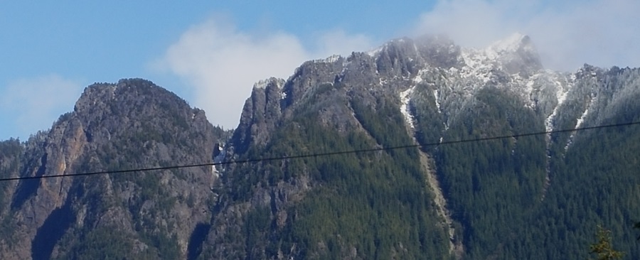
Purpose of hike: This was a hike to test clothing and navigation skills. I wore a neck band that can cover my head and face, long underwear and several layers of clothing, as well as heavy-duty gortex gloves. My companions were my brother-in-law, Dean Goodell, and his friend Jay Mohr, who has a cabin in the Andirondacks and served as a sort of guide (however, lacking technical navigation experience). We hiked on rock, snow and through muddy trails. The route took us from the southern end of Henderson Lake North Easterly  along the Calamity Creek Trail, during which I took bearings on Mt Marcy, 1,629 meters. I determined that the peak in view was at 84 degrees, almost due east and Jay said it was likely Mount Marcy. Later, we visited a roadside viewpoint with a plexiglas silhouette matching the landscape that supported this idea. A comparison of the Map My Hike application's map showing our route with the map of the area suggested that, although we had thought we had taken the Indian Pass Brook trail, we were in fact on the Calamity Creek Trail. When I returned to Dean's, I plotted the bearing on the map, suggesting that, at the time I took the bearing, we were close to a falls where a bridge over another waterway had been dismantled and set to one side. Unfortunately, I didn't record enough details to be sure. The bearing on the mountain intersected the trail, but I'm not sure the intersection truly indicated our position.

However, studying the topography and identifying hills in the area, I believe we had clear line of sight to the summit of Mt. Marcy.

I tried GoPro movies, but made mistakes in setting the camera properly due to the unfriendly way it attaches to the harness on my chest. I need to overcome the obstacles. I ended up inadvertently turning off the camera when I thought I was filming, and shooting time lapse when I thought I was shooting cinema.

Here are photos I took during the hike and a screen capture of the MapMyHike app:
(Note: Some images have text that may be small. These can be saved to your desktop and then enlarged in a viewer for easy reading.)

The Red line shows the south-to-north route of the round-trip hike. At the green "push pin" near the farthest extent of the hike there is a bump indicating a short side trip to investigate a route for viewing a small waterfall and a dismantled wooden bridge. The blue area adjacent to the push pin is a beaver pond. Near the bottom portion of the route there is a side trip to the tip of the finger of water that reaches out from Henderson Lake on the west. The topography of this map suggests a clear line of sight from the trail  to the summit of Mt. Marcy, almost due east.


Rich Lake, covered with a thin sheet of ice.

A sign for visitors at the historic McNaughton Cottage, where Roosevelt was staying.


Cast in stone: This plaque memorializes the historic ride of Teddy Roosevelt.

The McNaughton Cottage today.


A nearby cabin, abandoned and decaying.

The way station where Roosevelt changed horses, now boarded up.

Deteriorating interior of the way station.


In the near wilderness of the Adirondacks, a collapsed wooden bridge has been discarded at a waterfall, with no apparent intent to replace it.

Memorial tree: Over the years, the ashes of my wife and inlaws have privately reunited their spirts at the base of a tree known but to the family.


Thursday, April 7, 2016

April 7, Thursday, Scotia NY, Mohawk River

Distance: 11.36 km in two mini hikes.

Weight: 20# backpack
Weather: Overcast, light rain, torrent
Elevation gain:100 feet
Accumulation elevation gain for 2016: 21,794 feet.
Accumulated distance hiked: 185.13 km
Food consumed during hike:1 mini candy bar
Notes:
Prepping for Adirondack hike, which will have higher elevation, colder weather; near wilderness conditions  and a chance to practice map and compass skills. Today's hike commenced along levy of Mohawk river with views of vestiges of Erie Canal (see photo). This portion of hike (3.8 km) was accompanied by brother-in-law and paced at 2.38 mph. Then he headed home and I hiked back to his home, a distance of 7.55 km, following a course along the river and then through Schenectady to Scotia. Most of the path was fairly flat and I maintained a rate of 3.14 mph. Toward the end, the rain picked up and became almost torrential. My jeans were soaked; sunken sidewalk slabs defined basins holding 1-2 inches of water, and deeper streams poured around corners and puddled streets through which I practiced leaving no trace behind, thoroughly testing the gortex on my Asolo's. The cemetery I passed just before reaching my destination had a sandwich board at its entrance advertising spring discounts on plots. If I had been wearing jeans and this were the Adirondacks, I might have considered one.But the Adirondacks are in a few days and I won't be wearing jeans.
See PostScript, below*

Along the Mohawk

Mohawk River Levy Road. The river is to the right and can flood the lowland beside the levy.

A remnant of the Erie Canal along side the Mohawk River's levy road.

The solo portion of the hike, from the Mohawk into Scotia. The blue line on the graph indicates speed, the red indicates elevation. The drop in elevation toward the end is not supported in memory. Map My Hike is notoriously fickle for elevation.

*PostScript, April 7: Today I learned that that while I was being drenched by the deluge, the same storm had winds reaching 90 mph barely two miles away. My experience could have been far more challenging.


Saturday, April 2, 2016

April 2, Saturday, Little Si with SVTC

Distance: 9.28 km, car to car 

Weight: 20# daypack, 20# vest
Weather: Sunny, not hot
Elevation gain:1,300 feet
Accumulation elevation gain for 2016: 21,694 feet.
Accumulated distance hiked: 173.77 km
Food consumed during hike: 3 mini candy bars, apple, some tuna salad
Note: Hike Leader not seen; parking at 10 a.m. was impossible. But lady, there, Jane, retired airline employee, became hiking companion. Energy level not high. Because parking was bad, I drove down the road 1/2 mile and parked on the shoulder; that worked fine, and it was only a 10 minute walk back to the trailhead. "Accurate Altimeter" app was remarkably spot-on at the top: showed 1551 feet, and Washington Trails Assn lists it at 1550! I didn't take a fix at the trailhead for comparisons. Shot bearings at summit of haystack, and found it to be at 160 degrees; and at end of hike, shot bearing on Rattlesnake ledge, and got almost the same bearing. This suggests that Little Si wraps around Mount Si. Something to check against maps.

Photo taken from Dairy Freeze in North Bend.