Thursday, June 29, 2017

Twin Falls Triumph

Today was my third hike at Twin Falls east of North Bend, and it turned out to be a sea change. My energy levels were up, resulting in faster, sustained hiking and much greater distance. I and my hiking companion, Tammi Hermann, followed the Twin Lakes Trail all the way to its intersection with the Iron Horse Trail, which can be accessed at exit 38 on the I-90 Interstate. (Twin Falls is accessed at exit 34.)

(I am wondering whether the 30-minute nap I took in my car before the hike, and the 16-oz. can of Mountain Dew I drank just before the hike had anything to do with my renewed vim and vigor. Or maybe it was the rebound from the two hike I did a week earlier. Inquiring minds want to know.)

Tammi Hermann, my hiking companion.


We left the trailhead at 11:02 a.m. and returned at 3:45 p.m. I used Map My Hike to track the event. While I find the figures from that application highly suspect, I still use them in the absence of better data. More about the credibility of Map My Hike below.

The hike follows the path of the South Fork of the Snoqualmie River on its way to Snoqualmie Falls, so there were many views of the stream at the lowest elevation, such as that in the photo below.

There were many opportunities to skip stones, shoot photos, cool your feet and picnic.

This is a dynamic area,  with some elevation gain. As we passed the overlook to the falls at nearly a mile into the hike,  we came across two trees that had fallen over the path. That point on the path was unobstructed just six days earlier. The hillsides in this area are steep and these two trees had apparently outgrown the ability of the slope to sustain them.

Did one tree topple another on the steep slope?


An uphill view of the trail where the trees fell.


Click photo for the video.

Farther along the trail we descended a stairway to get a close-up view of the largest waterfall along the hike. For sight and sound, click on the photo for the video. The water pouring down this cliff is on its way to the much larger Snoqualmie Falls.

The video should open in a new tab, and you can return to this page by closing the tab.

This slug extended its eyes, mugging for the camera.


The upper falls

The path on this hike is almost like a sidewalk for much of the way. It is broad and smooth. But it changes after the bridge overlooking the upper falls, which can be much like a staircase.

The photo at the right shows a portion of the cascade, with one set of falls coming into a pool that then disgorges another waterfall. We counted at least four of these from the bridge overlook.

As we continued to hike, not exactly sure what we would find, the foliage closed in on us and we wondered whether the trail would end.


Most of the lower trail is broad and smooth.

This obstacle over the upper trail maked a point at which the trail was becoming more narrow.


At times we couldn't follow the trail without touching foliage on both sides.

We eventually saw wooden utility poles and came to the sign (right above).


Just when we wondered whether the trail could become even more narrow, we spotted utility poles and decided to walk at least that far. At the poles there was a sign pointing to the falls. We didn't realize it right away, but we had reached the junction with Iron Horse Trail, which is a very broad walking path that connects with Exit 38 from Interstate 90. The path led both east and west. To the west in the distance was the power station, shown above.

The hike follows the contour of the hillside, as does the I-90 freeway.

It's hard to know what to believe about Map My Hike software. The map seems to indicate where we walked, but topography probably interfers with the signal reaching my droid phone.

I know I didn't stray from the trail in the way the map indicates, and I know there were elevation changes that simply don't show here. And I know that the elevation at the trail head didn't change by 100 feet during the hike (see chart below). But we know that the signs along the trail indicated the hike to the bridge over the falls was supposed to be 1.3 miles, and the signal the Iron Horse Trail to the falls. So logically, the distance from there to the trail head was 2.2 miles. And I know we made side trips and walked to the power station, so I'm going with the five miles claimed by Map My Hike.

I'm calculating another 300-foot elevation gain over the falls to reach the Iron Horse Trail, and I'm adding the descent to the river a couple times. That's my story, and I'm sticking to it.

The route indicated by Map My Hike software doesn't match the superimposed trails map.


The smooth red line showing elevation changes doesn't reflect all the ups and downs of the hike.


Today's stats:

Distance:5 miles (8km)
Elevation gain: 800 feet

Load: 14 pounds
Total distance for the year: 177.28 km
Total elevation gain for the year: 7,160 feet

Sunday, June 25, 2017

Shit house luck at Twin Falls!

TRULY! Shit house luck.

Shit house luck.... I remember the evening I first heard the term. It came from the lips of a sweet lady I was planning on shooting pool with. She pulled up in her car, spotted the only parking spot on a crowded street, and proclaimed it Shit House Luck. I was a bit stunned, so I Googled the term and found out the likely source was the pleasant surprise someone had on a long hike when they had an urgent call from Mother Nature and suddenly spotted an out house.

Well on June 24 I was returning for a second, next-day hike at Twin Falls with two female hiking companions. We left the freeway and headed for the trail head in the late morning, and there was already a quarter-mile walk from the front of the line of cars along the road to the main parking area. I drove in planning to drop off my friends, and they asked me to wait while they used the bathroom. I didn't want to wait, but just then some folks whose car was parked right by the restroom returned to their vehicle from their hike. There I was, about to claim the premium parking spot for the day, and right beside the restroom, no less. Is that shit house luck, or what? I didn't need a bathroom, but I sure didn't want to leave my car baking in the sun a quarter mile from the trailhead. Thank you, Jesus, for that shit house luck!

Like yesterday, the hike was tiring. But I met a soul mate along the trail--a young bald woman who was hiking after chemotherapy for breast cancer. We high-fived each other for our common experience.

Here's a photo of me with my friend, Larisa, with a view of  the major waterfall along the hike:

And here's a video of that waterfall:
https://drive.google.com/open?id=0B6QZXqWxOZgwbTBuVmFnWHBJR3M

Today's stats:

Distance: 2.6 miles (4 km)
Elevation gain: 500 feet

Load: 14 pounds
Total distance for the year: 169.28 km
Total elevation gain for the year: 6,360 feet

Saturday, June 24, 2017

Twin Falls Exit 34

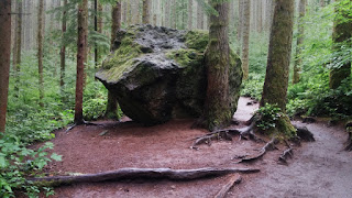
Nurse log above the stream bed of the Snoqualmie River's south fork, and beside the Twin Falls trail

View of largest waterfall

Washington Trails Association says the Twin Falls off of exit 34 on I-90 is only a 500-foot elevation gain and only 2.6 miles round trip, but it was as tiring as hiking Little Si or Rattlesnake Ledge, and it took just as long -- although there was a lot of dawdling along the trail because of it's beauty. There's also additional up-and-down along the trail, which follows the south fork of the Snoqualmie River.

"Twin Falls" is a misnomer, because there is a virtual staircase of falls. The tallest may be viewed  by descending approximately 200 feet from the trail to a platform high above the stream bed, which  gives a close view of the tallest falls. I chose to head beyond the bridge which overlooks the falls, following a path that eventually leads to the Iron Horse Trail. At between 1,190 and 1,240 feet elevation I turned back. The overall hike took four hours and I was ready for a nap afterward. The map at the bottom was provided by my hiking companion, Roger Matthews.

Distance: 3 miles (adjusted for extra distance), 4.8 ,m
Burden: 15 pounds
Elevation gain: 700 feet
Total distance for the year: 165.28 km
Total elevation gain for the year: 5,860 feet


Roger's Map My Hike record showing the highest point reached (Green Box)


Monday, June 19, 2017

Rattlesnake Ledge


This "sentry," greets hikers at trailhead

Yesterday was overcast and slightly drizzly at Rattlesnake Ledge, just south of Interstate 90 at Exit 32. I began the hike from my car at 11 a.m.; left the summit at 1:16 p.m., and returned to the trailhead by 2:28 p.m.

This yielded a climbing time of about two hours, similar to my ascent of Little Si on May 30. But the descent was relatively quick -- an hour and 12 minutes, which surprised me, because I was expecting it to take 90 minutes, the normal descent time from Little Si, a comparable hike.


My speed limit remains at 128 heartbeats per minute, down from more than 148 bpm in the past. I was packing 16 pounds in my backpack. I had to stop a few times to catch my breath and rest along the route.

A scene along the trail

Just as I arrived at the summit, I fielded a Father's Day call from son Tracy and daughter-in-law Shira, from Germany. Since there was a crowd and I was quite tired, I kept the call short.

Distance: 5.25 miles, 8.4 km
Burden: 16 pounds
Elevation gain: 1160 feet
Total distance for the year: 160.48 km
Total elevation gain for the year: 5,160 feet


June 18, 2017  hike, including from road to trailhead (Green box)


Wednesday, June 14, 2017

McDonald Mountain

McDonald Mountain is situated adjacent to Kangley, east of Maple Valley and south of North Bend. I hiked there Tuesday afternoon with Roger Matthews and Mary Vesper, following an old logging road to about 2,080 feet of elevation before we retraced our steps. We were all a bit out of shape, and the hike was a useful drudge that tired us all out.  Using Map My Hike software I measured the distance back to the car at 1.97 miles for a round-trip hike of four miles.

Washington Trails Association's figures for elevation gain are a bit confusing: The summit is listed as 3,750 feet, with a gain of 3,500 feet. My phone altimeter and figures from May My Hike show the starting point to be above 900 feet, so the figures don't make sense. WTA details can be found at their McDonald Mountain page, which includes an interactive map.

Roger has put in an effort to maintain the trail by digging steps or inclined side paths where the trail confronts undulations in the terrain, so today he and I each carried mattocks during the hike with an aim of improving the trail. That idea was discarded, and we just focused on the hike, which was comparable to Rattlesnake Ledge or Little Si, for as far as we went. I believe the hike lasted about 4 hours.
Distance: Approximately 4 miles (6.4 km)
Elevation gain: 1,100 feet
Load: Less than 10 pounds.


Total distance for the year: 152.08 km
Total elevation gain for the year: 4,000 feet

Wednesday, June 7, 2017

Banff National Park, Alberta

Moraine Lake in Banff National Park

Today Valerie Vessey and I hiked to Moraine Lake. We drove from the time share in Canmore. The hike was not long, and the day wasn't hot, but we were sluggish. Later we learned that the elevation of the hike was 5,000 feet. Elevation may have been part of the problem. It was our first real hike since we arrived late Monday evening after an exhaustive drive. I did not record length or elevation gain, but the hike was likely no more than 3 km.

Afterward, as we were leaving, we talked to a traffic attendant at the park who told us a young female grizzly was just over the hill. We watched for a while but did not see it.