Monday, March 28, 2016

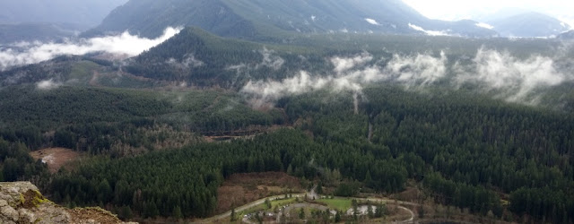
March 28, Monday, 20# pack on Tiger 3 Trail

Distance: 9.6 km round trip 

Weight: 20#+ day pack.
Temperature: 8 C = 46.4 F *
Barometric pressure: 1023 hPa *
Longitude: 47.51 / Latitude: 121.99*
Elevation gain: 2,000 feet,from 500 to 2,522.
Accumulation elevation gain for 2016: 20,394 feet.
Accumulated distance hiked: 164.49 km
Food consumed during hike: 4 mini candy bars
Note: Hiking companion Arlene Levy and her poodle. Energy level not high; it has been three days since Mt. Si hike. This was mostly the same route I took on my night hike with Mountaineers.
* From new altitude app, "Accurate Altimeter." It proved to be fairly close to figures at trail head and summit. Downloaded from Play Station.

Sunday, March 27, 2016

March 25, Friday, 40# up Mount Si

Distance: 9.6 km round trip 

Weight: 40+ with day pack and  weight vest; total hiking weight over nude weight: 55 pounds.
Elevation gain: Likely 2,300 feet (3/4 of 3,150 (WTA figure)
Accumulation elevation gain for 2016: 18,394 feet.
Accumulated distance hiked: 154.89 km
Food consumed: 8 mini candy bars, 1.5 hard-boiled eggs. 
Note:
  • Averaged 1 mile per hour to 3-mile point
  • 8:37 a.m. started hike
  • 9:45 at the snack bar
  • 10:20 1.7 mile mark
  • 11:00 Hitchin' rack
  • 11:28, Three-mile mark
  • 11:45, Hitchin rack (on way down)
  • 12:19, 1.7 mile mark down
There was a mother bear and her cub reported on the trail on Snag Flats.
I didn't use trekking poles coming down. However, I had injuries to three toes on my right foot; they were sore at dance Friday night and the foot remained sore through Saturday.
Light dusting of snow on the trail and reported bad visibility at Mt. Si ledge at the top.

Mt. Si view from North Bend Dairy Freeze


Thursday, March 24, 2016

March 24, Thursday, Yoga Class

Distance: 4..6 km in round trip to 24 hour fitness

Weight: 20 pound weight vest
Elevation gain: 200 feet based on conservative reading of figures for Map My Hike.
Accumulation elevation gain for 2016: 16,094 feet.
Accumulated distance hiked: 145.29
Food consumed: 500 calories from cookies provided by 14-hour fitness.
Note: Forgot mat, so just walked back home.

Wednesday, March 23, 2016

March 23, Cougar Mountain with SVTC

Distance: 13.6 km in two parts

Weight: 18# backpack (forgot water)
Elevation gain: 800 feet based on conservative reading of figures for Map My Hike.
Accumulation elevation gain for 2016: 15.894 feet.
Accumulated distance hiked: 141.13 km
Food consumed: 1 Pink Lady Apple; 4 mini candy bars some cheese.
Notes: This was a Snoqualmie Valley Trails Club sanctioned hike. As I geared up, realized I had left my platypus cooling in the fridge. Harumi, the guide, gave me a water bottle. When our group reached Coal Creek Falls, I wanted to shoot a photo and discovered I had left my phone on my car dashboard and failed to lock car. I excused myself from the group, retraced my steps to the  car and called hike leader Harumi (at her request) to tell her my phone hadn't been filched. Then I went off on my own, misreading the sign below:

I thought the arrow for Sky Country Trail applied to Cave Hole Trail.

Coal Creek Falls

My misreading of the sign left me hiking Military Road Trail westward (kinda) until I came out to a highway, Golf Club Road, which I crossed to reach the Red Town Trail. I backtracked, found Cave Hole Trail, and followed it, taking a side jaunt to the Red Town Dam site, then, later, another side trip back to Coal Creek Falls before returning to my car. I misread the map several times, trying to figure out where I was, and didn't even notice the Coal Creek Falls Trail, which I thought had been left off the map.
I used Map My Hike to sort out what I had done and comparing that application's map to the map I printed prior to the hike.

Tuesday, March 22, 2016

March 22, Tuesday, Rattlesnake Ledge

Round trip = 6.88 km from car to ledge

Weight: 20# backpack and 20# weight vest.
Elevation gain: 1,160 feet*
Accumulation elevation gain for 2016: 15.094 feet.
Accumulated distance hiked: 127.53km
Food consumed: 1 Pink Lady Apple; 2 mini candy bars (360 calories) one hard boiled egg.
Note: Climb to the top took one hour and 35 minutes. I was hiking with Tammi Hermann. She was not prepared for rain, so I provided the plastic pullover rain coat and it kept her dry. Surprisingly, although we did not hurry, the hike only took 20 minutes longer than yesterday. I did my first yoga class this morning at 24-hour fitness, and while it was strenuous, it did not appear to affect this hike.
*Washington Trails Assn.

Monday, March 21, 2016

March 21, Monday, Rattlesnake Ledge

Round trip = 6.88 km from car to ledge

Weight: 20# backpack and 20# weight vest.
Elevation gain: 1,160 feet*
Accumulation elevation gain for 2016: 13,934 feet.
Accumulated distance hiked: 120.65 km
Food consumed: 1 Pink Lady Apple; 1/2 cut tuna salad; three mini candy bars (560 calories).
Note: Climb to the top took one hour and 15 minutes.
*Washington Trails Assn.


Sunday, March 20, 2016

March 20, Sunday, Madison Park

Round trip = 8.57 km

Weight: 23# backpack with 2 5-pound weights; 20# weight vest; 3# in sweated clothing, jacket and fly fishing jacket. So: packing 45 pounds.
Elevation gain: 500 feet*
Accumulation elevation gain for 2016: 12.774 feet.
Accumulated distance hiked: 113.77 km
Note: Wore rain slacks with large binder clips to keep the pants in place. Worked well. Recorded with Gaia, which promptly discarded the information because I didn't mail it to myself right away.

* Elevation gains are estimated; May My Hike highly variable and unreliable for elevations, so I made conservative estimates based on how I followed the lay of the land.